
Airports & Airfields
Ground vehicle tracking, movement area alerting, and incursion prevention for airports
Every aircraft shows up on a screen. Not every ground vehicle does
Ops trucks, maintenance crews, fuelers, mowing and construction convoys, winter storm shifts, wildlife patrols, and escorted visitors all work the same surfaces the aircraft do. Each carries different authorizations, different escort requirements, and different areas they are allowed to enter, and the mix changes with the season and the construction schedule.
Surveillance is built around aircraft, so this entire ground picture runs on radio calls and driver training. That leaves vehicle and pedestrian deviations (VPDs), the ground side's share of runway incursions, along with escort rules nobody can verify while they matter, contractor surges that outpace the badging office, and investigations built from statements because there is no position record.
RTS is built around preventing that incursion. Every ground vehicle and person goes on one live map alongside ADS-B aircraft positions, alert rules are scoped by vehicle category and zone, and a vehicle deviating toward a runway triggers a warning in the cab and the operations center before the deviation becomes an incursion. Every movement on the surface is recorded.
A ground fleet the tower does not track
Aircraft carry transponders. The trucks, sweepers, and contractor vehicles working the same surfaces are on the radio at best, and invisible at worst.
Procedures without verification
Driver training, escort requirements, and area authorizations rely on compliance nobody can confirm while it is happening.
Investigations built from memory
Without position history, a surface deviation or near miss is reconstructed from statements. The record ends where recollection does.
The Site Awareness Platform
The Site Awareness Platform puts the ground fleet on a screen of its own: RTS trackers on every vehicle and person, vMonitor as the alerting engine and user interface, and ADS-B aircraft on the same live map.
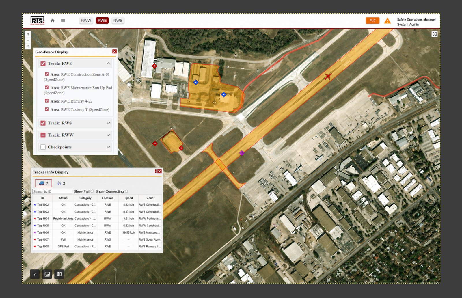
The alerting engine is aligned to FAA AC 150/5210-25A, the FAA's performance specification for airport vehicle runway incursion warning systems.
How the Platform Fits
Every ground vehicle and person on one live map
Trackers on the fleet and personnel, ADS-B feeds for aircraft, and phone-based tracking for contractors and visitors, all in the same picture the operations center watches.
Alarms scoped so they mean something
Every tracker carries a category. Speed, wrong direction, and unauthorized area rules are set per category, per zone, so alarms trigger only where that class of vehicle should not be.
Seasonal and contractor traffic covered on day one
Winter crews, construction contractors, and visiting teams onboard at the gate with an issued tracker or a QR scan into the mobile app.
Incident Replay for every investigation
Position histories are recorded, so a surface deviation is reconstructed from data. Safety teams see what happened, where, and which rules triggered.
Use Cases

Movement Area Access & Alerting
Category and permission-aware alert rules for airfield surfaces, so alarms mean something when they trigger.
Read the Use Case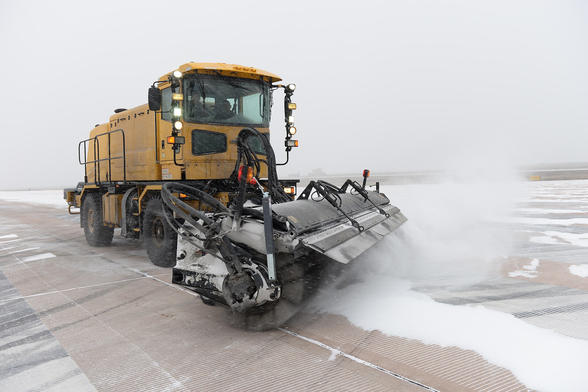
Winter & Seasonal Operations
Storm shift coordination, verified coverage for billing and claims, and fleet health for snow and ice operations.
Read the Use Case
Visitor Monitoring
Live location and escort enforcement for visitors and short-term access across the airfield.
Read the Use CaseReady to enhance your operations?
Contact us today to learn more about our Airports & Airfields and how they can benefit your organization.
Contact Us